
Back to Ohio to Erie Trail Tour: Day 1 – North Bend to Cincinnati to Waynesville
I woke up in time to put on my clothes and walk up the street soon after the 7:00am opening of the Village Family Restaurant. I order the breakfast Combo #1, which included everything (eggs, bacon, hash browns, and toast), and decided to add an a la carte pancake. This ended up being way too much food, and I couldn’t finish it all, but it was all good.
After heading back to the hotel, getting dressed to ride, re-packing everything else, and checking out, I ended up with the same start time of 9:00am as I had yesterday. There was a light, misty rain when I got started. I initially took this as a good thing, thinking “Oh, that will keep the heat and the beating sun away.”
I rode back through downtown Waynesville and the short stretch of road to the village of Corwin to get back onto the Little Miami Scenic Trail. A few miles in, I passed a male-and-female couple that appeared to be bike-touring, heading in the opposite direction. We didn’t stop; we were probably both thinking it best to keep moving and not stand around in the rain, but I later regretted not stopping to chat and get their story. Were they also on the Ohio to Erie Trail, or were they headed even further on the Underground Railroad Bicycle Route?
I confirmed that the re-calibration of my bike computer that I did last night was successful. The trail is marked in half-mile increments, and the distances indicated by these markings seemed to be spot-on with my computer.
I came to the end of the Little Miami Scenic Trail in Xenia, the hub of Southwest Ohio’s bicycle trail network, where five different trails converge at Xenia Station.
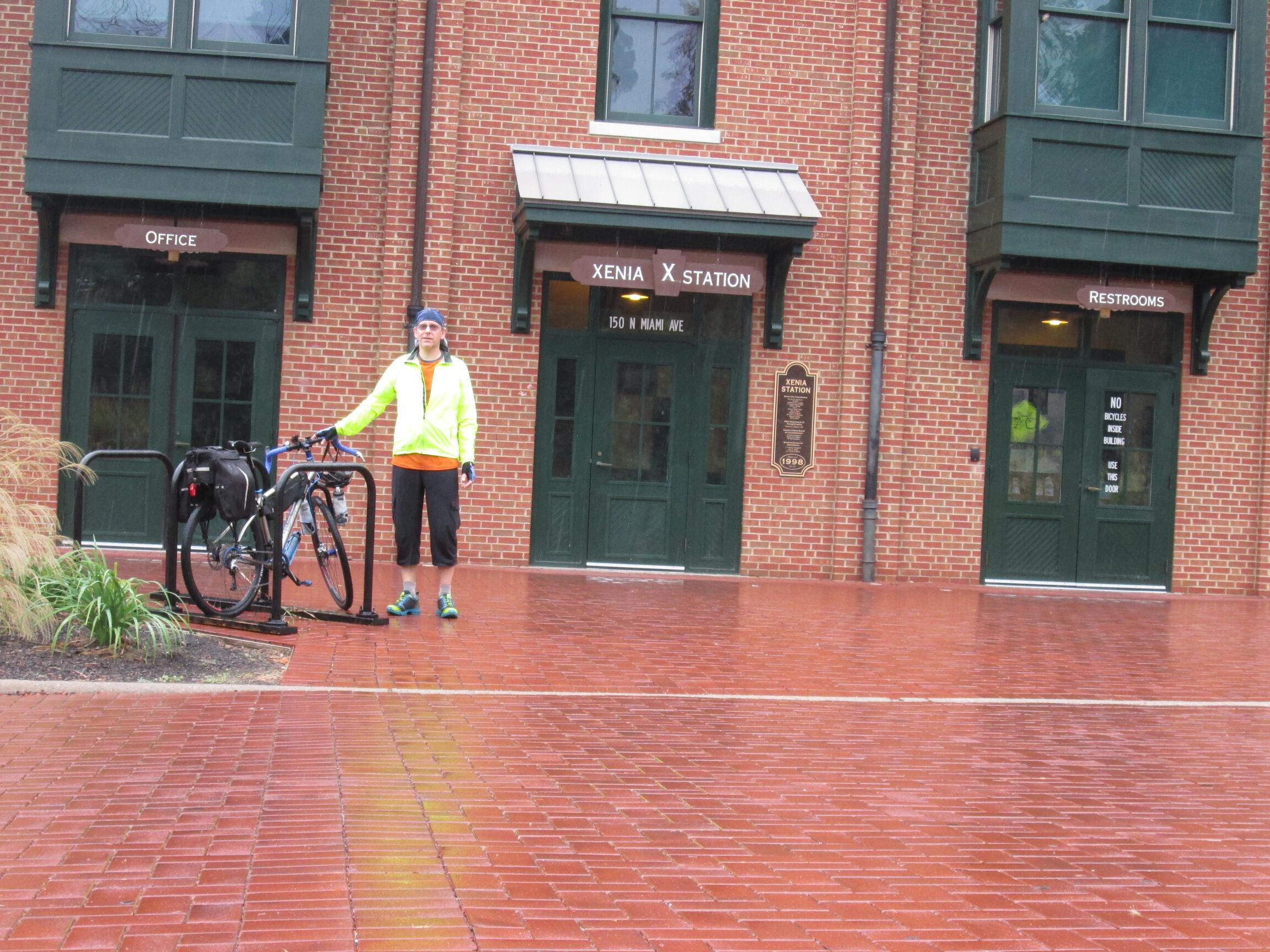
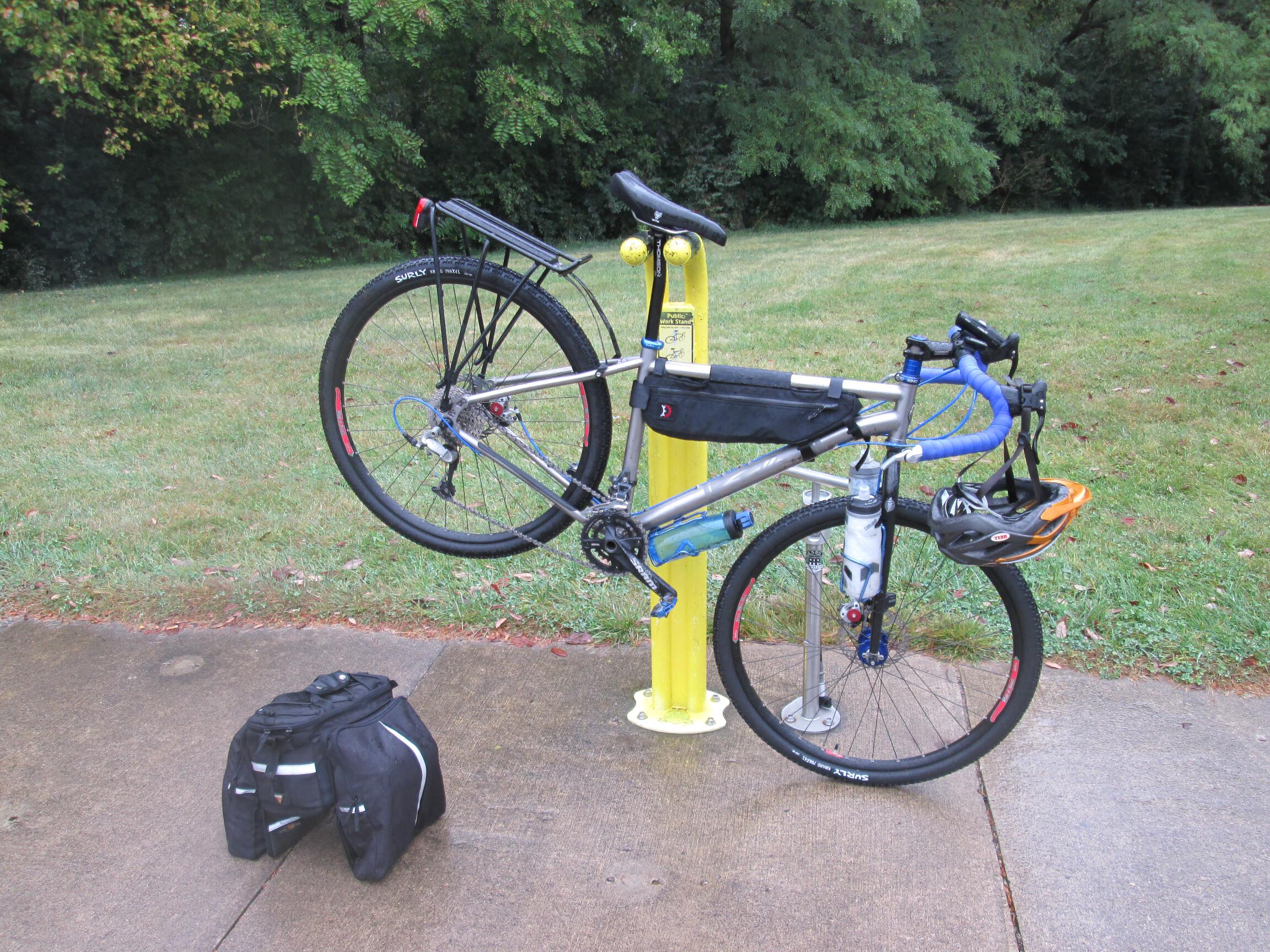
There is a water fountain to the right of the Xenia Station building, so I topped off my bottles. To the left is a do-it-yourself bike repair station, with a pump (presta and schrader compatible) and an assortment of tools. I took advantage of it to top off my tire in which I had replaced the tube late in my ride yesterday, plus made an adjustment to my rear derailer, which had been shifting a little wonky since the start of my ride yesterday.
The Ohio to Erie Trail continues from this point on the Prairie Grass Trail. From Xenia Station, you turn left onto Detroit Street, then make an immediate right onto Hill Street, then an immediate left onto the trail. However, there is a telephone pole on Detroit Street just before the corner of Hill Street, and there is a sign for the Ohio to Erie Trail on this pole. The sign has a two-part arrow on it; the first part goes straight ahead, then the second part of the arrow leans slightly to the left. (I wish I had taken a picture to better illustrate it.) Now, this sign might make sense if you were standing on the opposite side of Detroit Street and looking down Hill Street, but there is no street or trail coming from that direction. The sign makes no sense at all coming from the direction that people would be naturally coming from Xenia Station. This was one of only a couple of times where I found the Ohio to Erie Trail signage to be confusing and misleading. Now that I’ve done it, the correct way is obvious, and I could do it a hundred more times and it would obvious every time. But any sign is obvious if you already know the way; signs are supposed to be most helpful for those who DON’T already know the way.
Anyway, as I continued on the Prairie Grass Trail, the rain started to come down a little harder. I passed through the town of Cedarville, which looked like it would be a nice place for an overnight stop should you find yourself in that location at the right time. There’s a local restaurant right on the trail, a couple of coffee shops nearby, the local public library is right on the trail, and the Hearthstone Inn & Suites located right next to the trail, where they had a sign saying “Welcome Cyclists” next to a free water fountain (where I topped off my bottle once again).
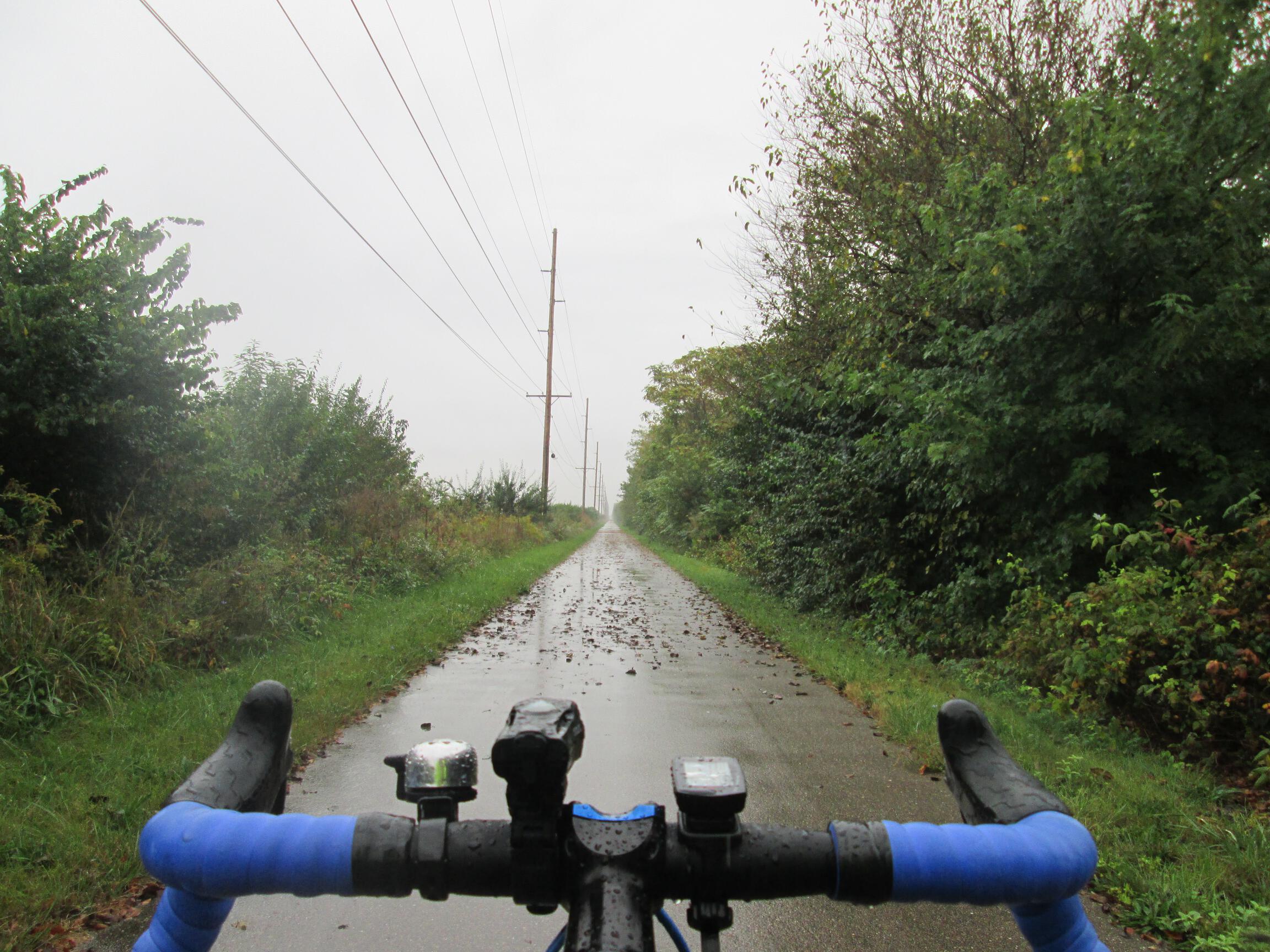
The open plains of this part of the state make for some of the longest, straightest, and flatted sections of bike trail that I’ve ever seen.
The Prairie Grass Trail continues through the village of South Charleston with a brief on-road detour. I stopped at the trailhead for a bathroom break and to refill my water bottles once again.

As I made my way through town, I passed a group of cyclists near a van with a trailer attached. It looked like a supported touring group, so I stopped to ask them what they were up to. Turns out, they were a church-affiliated group doing a fund-raising ride to build an orphanage in Ukraine. I told them I was headed home to the Cleveland area on the Ohio to Erie Trail. They were doing a loop of their own creation between the Dayton and Cincinnati areas. Their organization is called Ends of the Earth Cycling, and you can find out more about them at: endscycling.com
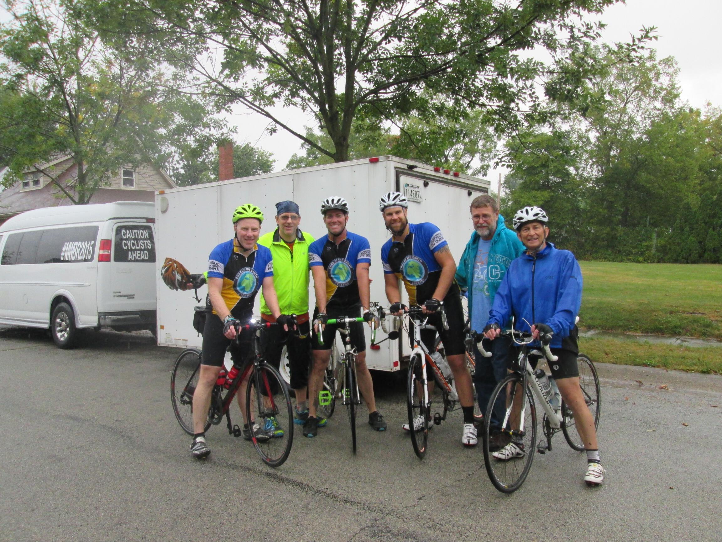
There were four riders in the group that I stopped to talk to, plus their two support drivers. They told me to keep an eye out for the eight other members of their group on the trail, heading the opposite direction from me. When I got back on the Prairie Grass Trail, I did see them soon after.
Before seeing this group of cyclists, the day was starting to wear on me. I usually don’t mind traveling alone, but the solitude was getting me down a little, plus the continuing rain probably didn’t help, either. Chatting with them gave me a second wind and much-needed mid-ride pick-me-up.
The Prairie Grass Trail ends in the town of London, which I chose as my lunch stop for the day.
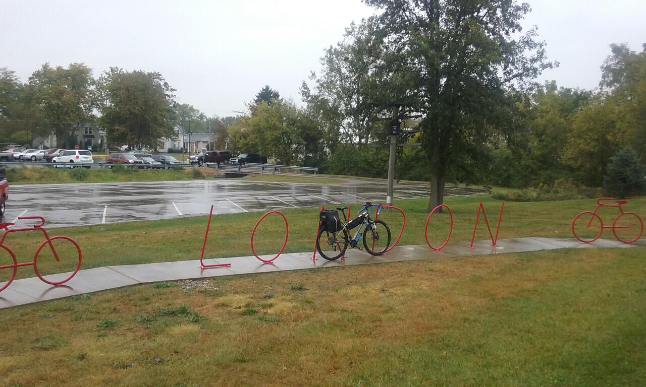
At the trailhead, there was a convenient map listing the restaurants and other amenities in town. I chose Ronetti’s Pizza, as it seemed like a nice local option, located on Main Street near the center of town and on the bike route. I locked my bike up to a railing near the curb, and planted my soggy self at a table near the front window. I chose a fish sandwich, washed down with a Sweetwater 420 Extra Pale Ale. The service was cheerful and efficient.
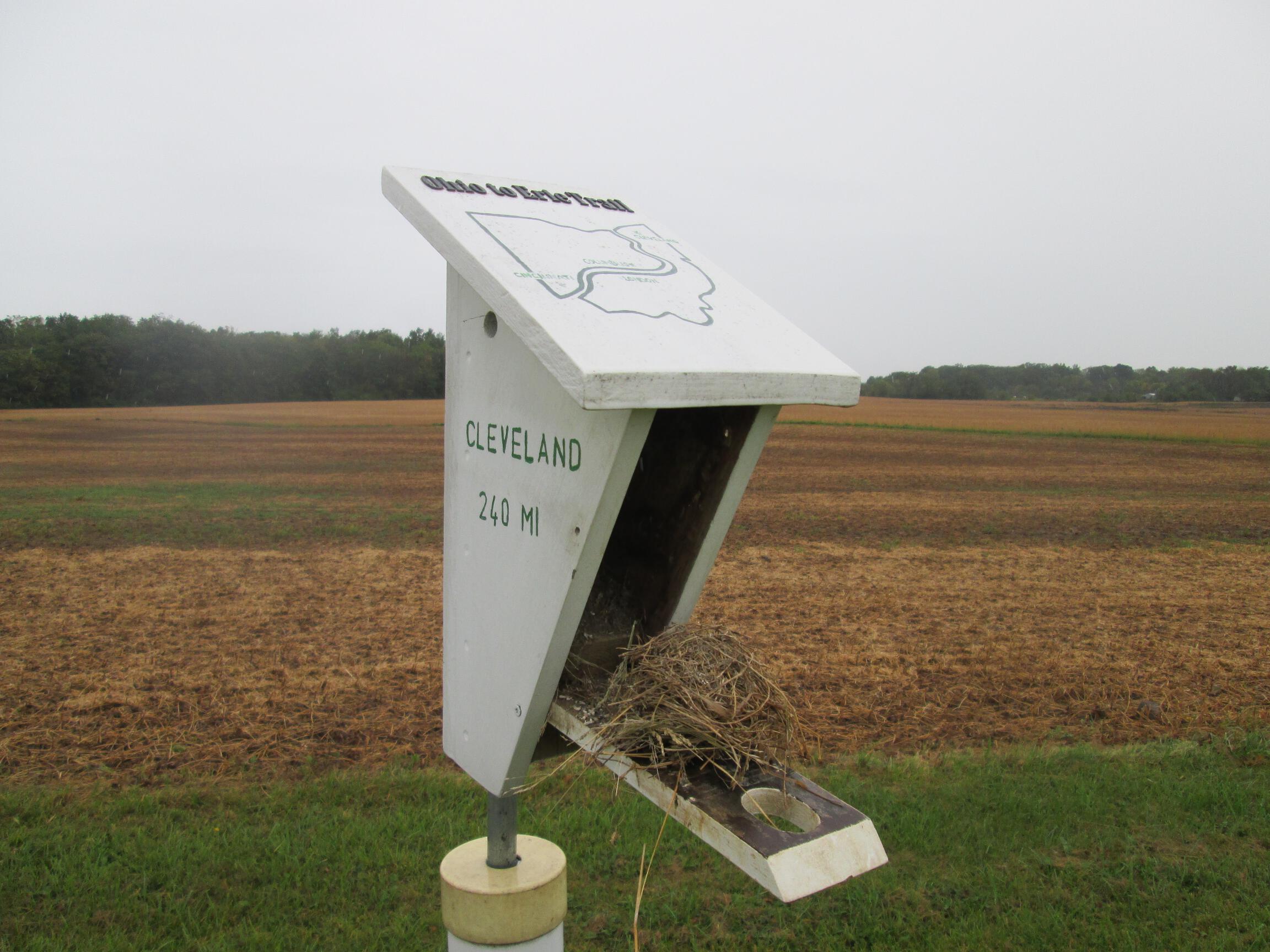
Back out in the saddle, the rain wasn’t showing many signs up letting up. I followed the Ohio to Erie Trail signs for the on-street connections, which led a few blocks to the Roberts Pass Trail. About halfway between London and Georgesville, this trail becomes the Camp Chase Trail. I came across this reminder of the journey still ahead of me somewhere along the way:
My journey on the Camp Chase Trail ended at the Battelle Darby Creek Metro Park. The Camp Chase Trail continues northeast from there, and nearby, the Darby Creek Trail goes north. I would be taking neither of these options, though, and going off-route from the Ohio to Erie Trail, as my destination for the evening was relatives’ house in the small village of Lockbourne, just outside of Grove City.
I had mapped out the route at home a week earlier, and had a hard-copy with me. I retrieved the printout from my trunk bag, folded it up, and put it in my jacket pocket. I hoped it would stay dry enough long enough to be useful for navigation.
The 14-mile route was a combination of lesser-traveled back roads and a couple stretches of very busy roads, mainly State Route 665, a.k.a. London-Groveport Road. This road is very narrow with very little shoulder, with lots of fast car and truck traffic. Add in the limited visibility with the rain, and needless to say, it was white-knuckle cycling.
The feelings about bicycling in the rain are kind of like the Five Stages of Grief. When I left Waynesville this morning, it was like Denial, or “Oh, this will be a nice change of pace.” By now, I had reached the Acceptance stage. When you are totally soaking wet, there’s no point in worrying about it any further, because you can’t get any more wet.
I reached my relatives’ house much to their relief as well as amusement at seeing my soaked self. My mileage for the day showed 68 miles. I suspected that was a little light; maybe the rain had gotten the sensor on my bike computer a little water-logged and worn the battery down a bit.
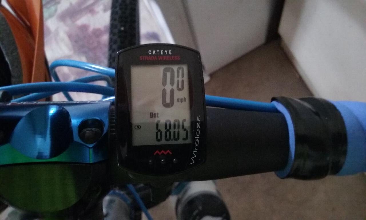
The online route map shows about 72-1/2 miles. Either way, a hot shower, a home-cooked meal, and laundry were a welcome relief. Later, I peeled apart my other map printouts and route notes and laid them out on the garage floor to dry.


Leave a comment