
Back to Ohio to Erie Trail Tour: Prologue
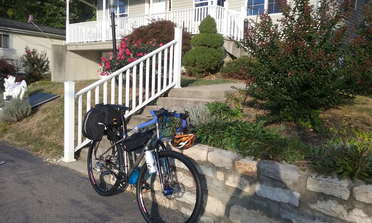
I slept pretty well and woke up a little after 8:00am this morning. I re-packed my clothes, topped off my bike tires, and gave everything else a final check-over. I took off from Austin’s house right at 9:00am.
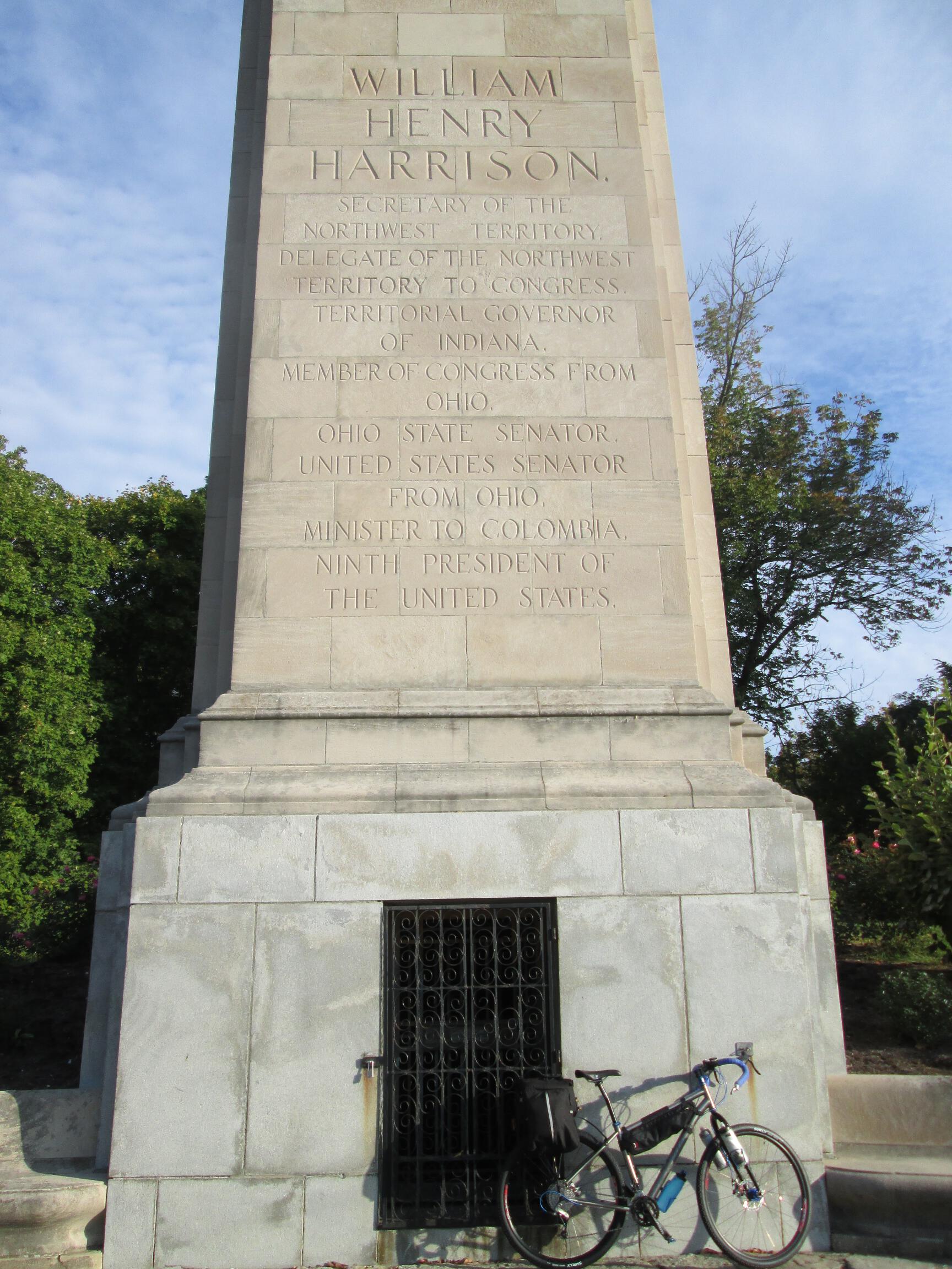
The village of North Bend is the home of William Henry Harrison, 9th president of the US, and his tomb are right near the center of town, so I stopped for a photo op.
The main road between North Bend and downtown Cincinnati is a busy four-lane highway known as the Three Rivers Parkway, or US Route 50. Austin told me that many cyclists use this road, but I opted to play it safe a find a route that avoided it as much as possible. I rode on US 50 for about 2 miles out of North Bend, where much of it had a nice, wide shoulder. Near the neighborhood called Sayler Park, I detoured through a couple of local streets to make my way over to Hillside Avenue, which parallels US 50 for most of the way downtown. It’s a gently rolling road with very little motor vehicle traffic; I was passed by one, maybe two cars the whole time. There were some rough spots and patches of gravel, but nothing a Salsa Fargo couldn’t handle with ease.
Hillside Avenue ended back at US 50 about 2 miles short of downtown. There was little to no shoulder, and there still seemed to be some remnants of rush hour traffic, so I followed the sidewalk on the right side for much of the way, until the sidewalk was reduced to about 10 inches wide, so I jumped over the to left side and followed this until it took me to State Avenue, my first turnoff into downtown. From there it was a right onto 8th Street, and then proceeding on 7th Street. It was about 18 easy miles from my start into downtown.
My plan was to have breakfast here in town, and I had earlier located a First Watch restaurant. Locating this place ended up being the most difficult part of my whole day. The address was 700 Walnut Street, and that street was a cross street of 7th Street. I came to Walnut Street, and walked up and down a couple of blocks each way, not seeing the restaurant. I pulled out my phone on the corner of 7th and Walnut and tried using Google Maps walking directions. As soon as I tapped the “Start Navigation” button, it said “You have arrived.” I gave up and proceeded to continue east on 7th Street, and lo and behold, there it was about half a block up. I locked my bike bike to a pole outside and asked for a table near the front window so I could keep an eye on it.
The waiter took my order for coffee before I even sat down, but it was at least 10 minutes later, after I had ordered my meal, before I ever saw the coffee. Things went smoothly after that, though, and the pumpkin pancake special was delicious.
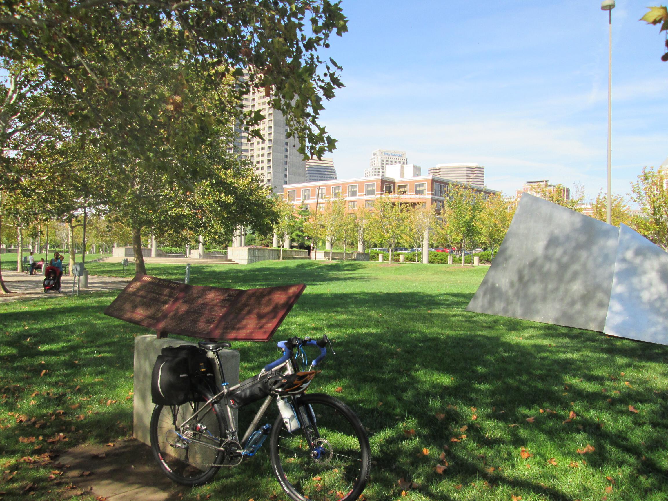
I continued on the bike over a few short streets to Yeatman’s Cove Park on the Ohio River, the official starting point of the Ohio to Erie Trail.
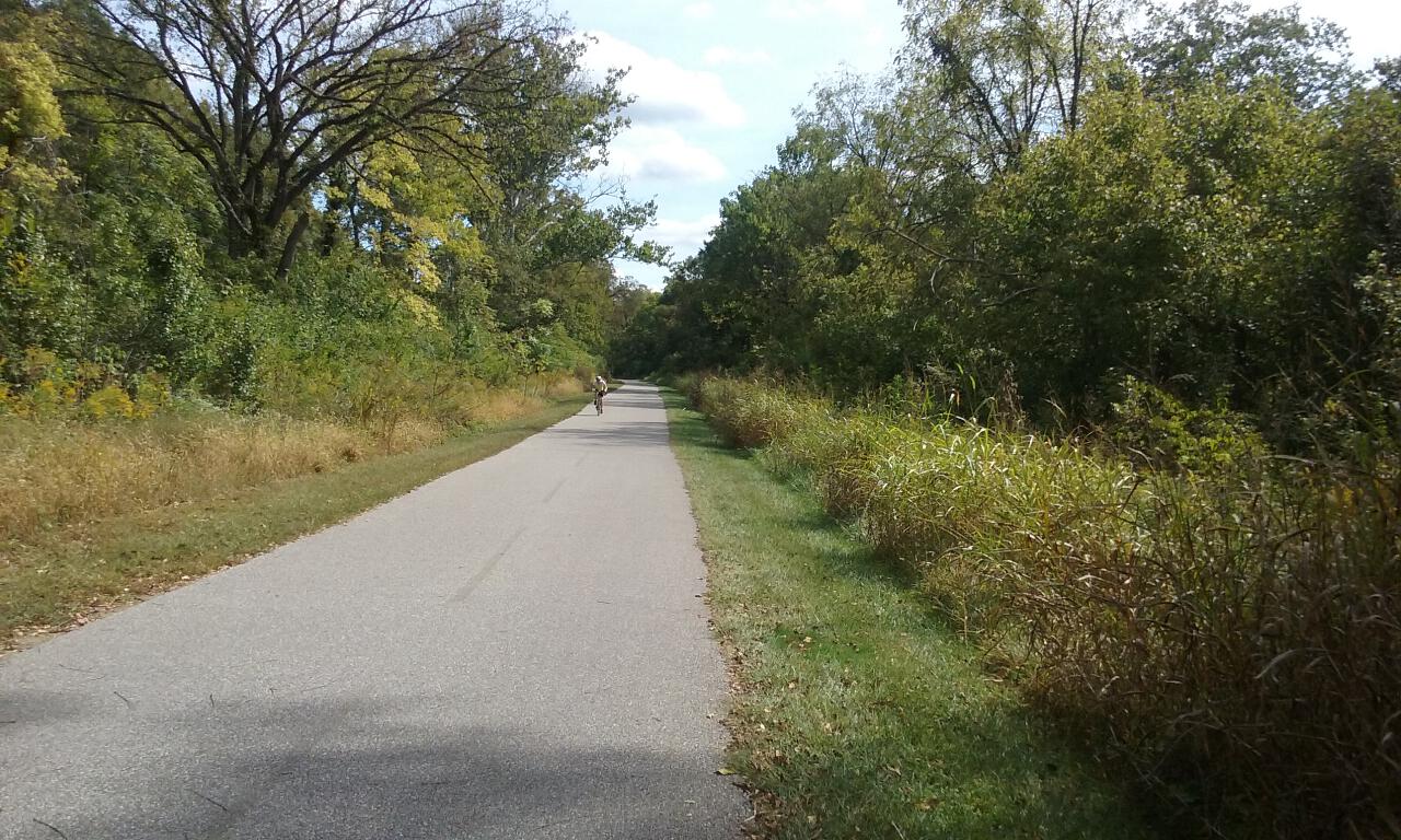
The next part of the ride was the one I had been most worried about — getting out of downtown Cincinnati. This ended up being easy-peasy. From Yeatman’s Cove Park, you turn right onto Pete Rose Way, and follow the signs for Bicycle Route 1. It’s a combination of roads and paved bike path, actually more bike path than I expected. It’s back on US Route 50 for a couple of stretches, including a busy 2-lane stretch through the upscale community of Mariemont, and a 4-lane stretch after that, but I found all of the drivers to be careful and courteous. In short order, I made my way onto the Little Miami Scenic Trail at the intersection of US Route 50 and Newtown Road, a few miles south of Milford.
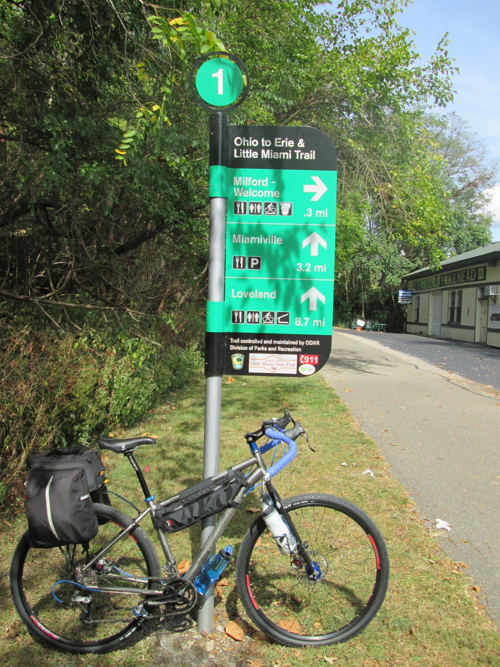
I pedaled the few miles to Milford, and decided to detour through town to browse some of the shops, including Bishop’s Bicycles and Roads River and Trails outdoor store, where I bought the only major item I forgot to pack, a tube of lip balm.
I got back on the trail and headed north to my lunch destination of Loveland, passing under this view of Interstate 275 along the way.

Also passed by this nice Miami Riverview Park on the way.

Loveland is one of those sleepy old towns that has seen revitalization as a direct result of the bike trail. There are several restaurants right on the trail, as well as a bike shop (Montgomery Cyclery). I chose to stop at Julian’s Deli & Spirits for my lunch, with trailside bike parking, and a good selection of sandwiches and bottled craft beers. After an Avocado Ranch Panini and a Fat Tire Ale, I was back on my way up the trail.
During the next several miles, I saw signs along the trail that said something to the effect that the trail would be closed “on selected weekdays” between 7:00am and 5:00pm, September and October, between mile 30 and mile 30.5 near Grandin Road. The trail mileage is marked every half-mile, so I paid attention as I got near this point. I saw other people riding in the opposite direction of me coming from that point, so I assumed that meant it was open. That assumption was wrong, however, as I got here:
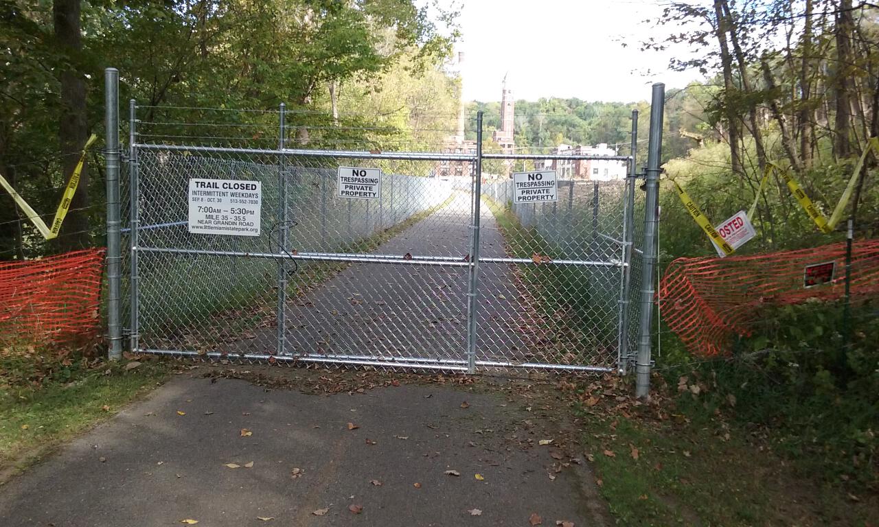
This was the first of many cases where Google Maps proved invaluable during my trip. I back-tracked just a bit on the trail, and found an access trail (paved but rather steep) that led to a new housing development. I followed the streets of the development, which eventually led me to Grandin Road. I wasn’t sure, however, if Grandin Road was within or beyond the closed section of the trail, so to play it safe, I went the other way and used Google Maps again to find another access point beyond that. Grandin Road led to State Route 48, which I took to another housing development and golf course community, which had another paved access trail back down the ridge to the main trail.
A few miles up, I started to get that squishy bike handling feeling, which is confusing at first, until you realize that it’s a sign of a flat tire. Sure enough, my rear tire was flat. I assumed that the numerous bits of glass that I had seen along the shoulders of the roads around Cincinnati had finally caught up to me, but I didn’t find any glass shards in the tire itself. A spare tube and 15 minutes later I was rolling again.

More miles of trail eventually found me in the village of Corwin, where it was a short half-mile road detour to the town of Waynesville and the Creekwood Motel, my destination for the evening. Check-in was without incident, and I showered and relaxed for a bit before heading out to find dinner in town.
My bike computer showed almost 81 miles for the day, which I thought was high based on when I planned my route earlier, even accounting for the detour around the trail closure.
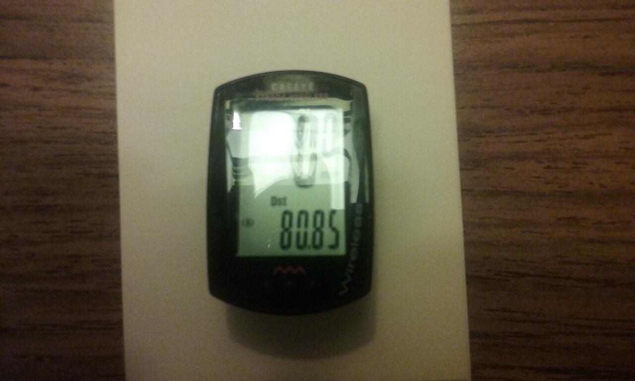
I realized this was because I had forgotten to re-calibrate the computer after switching from the 29er tires to the 700×41 tires yesterday. I pulled up the Cat Eye tire size chart on my phone, which has entries for a 700×40 and 700×42, so I split the difference and entered a wheel circumference of 2212. I’ll see tomorrow how close this comes, but based on my route on MapMyRide.com, the actual distance for today was about 73 miles.

I went to the Stone House Tavern for dinner. Their menu had a lot of interesting sandwiches, but then the New York Strip Steak dinner caught my eye, and it was very reasonably priced, so I went for it, with calamari fries and snap peas for the two included side dishes. The steak was cooked perfectly medium. I paired the dinner with a Hippie Trail IPA, a collaboration between Warped Wing Brewery and Yellow Springs Brewery.
When the server came back to ask me about dessert, I thought I was already too stuffed, but then she mentioned that they had cinnamon roll bread pudding. I’m a sucker for bread pudding, so I had to go for it again, washed down with a local pumpkin ale.
Next: Ohio to Erie Trail Tour: Day 2 – Waynesville to Lockbourne


Leave a comment