
Back to Ohio to Erie Trail Tour: Day 3 – Lockbourne to Howard
After a delicious breakfast courtesy of my hosts Pat and Dick, I stuck to my usual schedule of getting back on the bike around 9:00am. I rode the short stretch from their house through the village of Howard back to the Kokosing Gap Trail and was on my way. Just a few miles up, the trail ends in Danville. I was confused at first and ended up heading out of town about a half-mile the wrong way. I stopped to re-check the map, and realized I was just reading it wrong, and headed back to get on the Mohican Valley Trail.
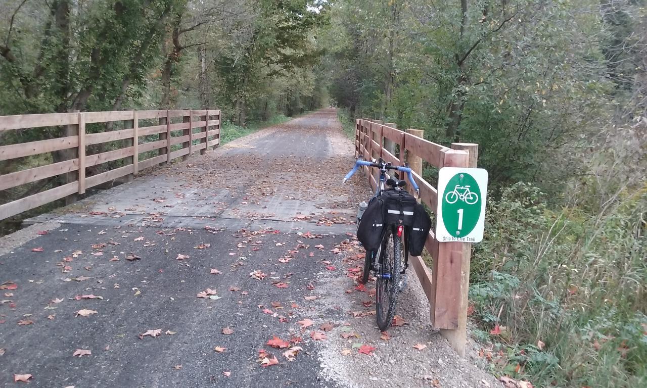
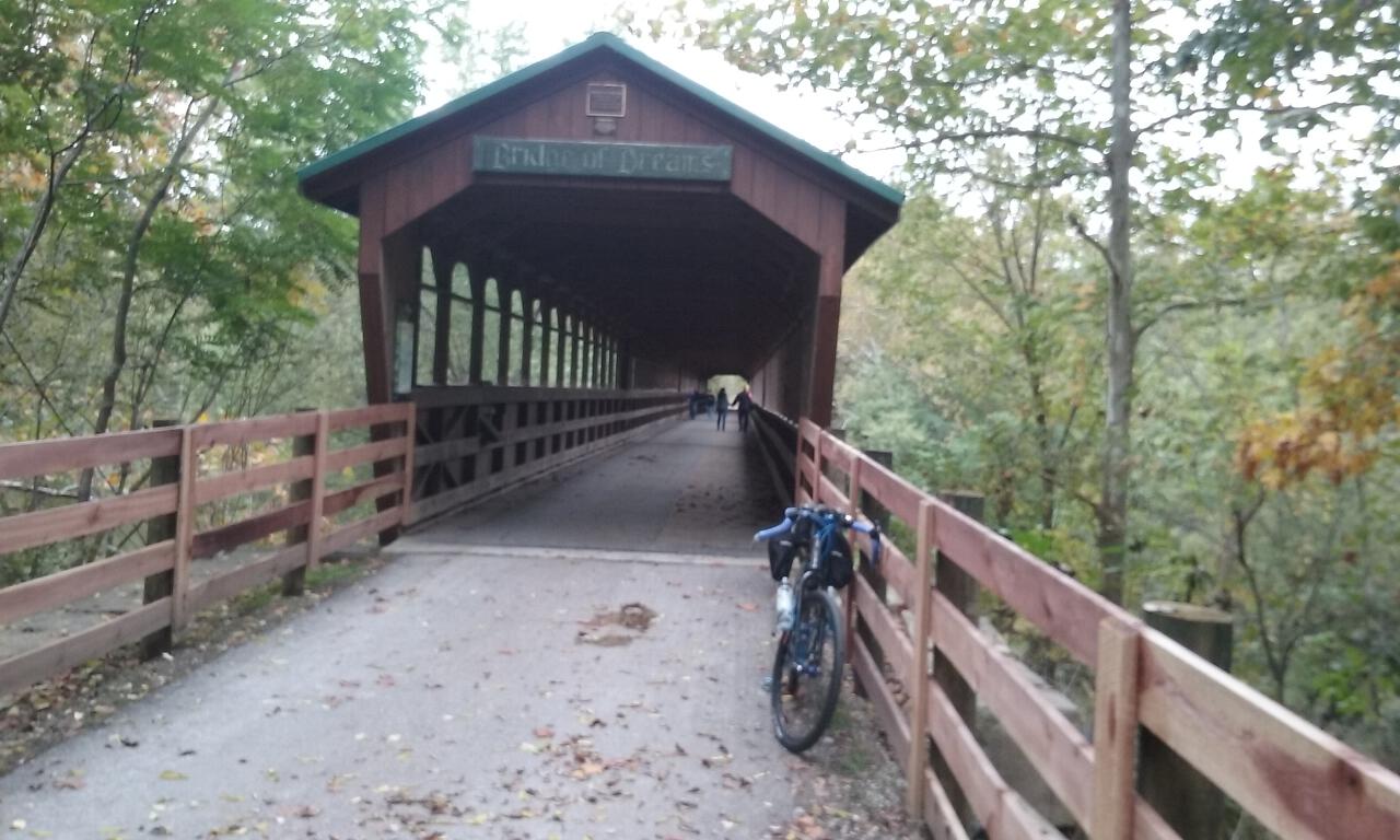
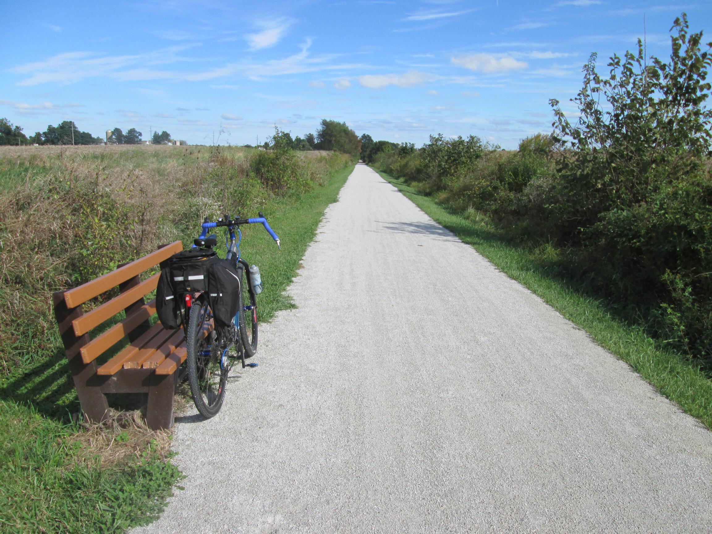
The Mohican Valley Trail is the first un-paved trail on the south-to-north route of the Ohio to Erie Trail. It’s very well packed dirt and crushed limestone, though. After several miles, you come to the Bridge of Dreams, the longest covered bridge in Ohio.
Just after the Bridge of Dreams, there is an Ohio to Erie Trail sign, indicating that you should continue on the Mohican Valley Trail. A short stretch further, I went through a short tunnel that appeared to go under a major road. Right after that, I came to this confusing sign:
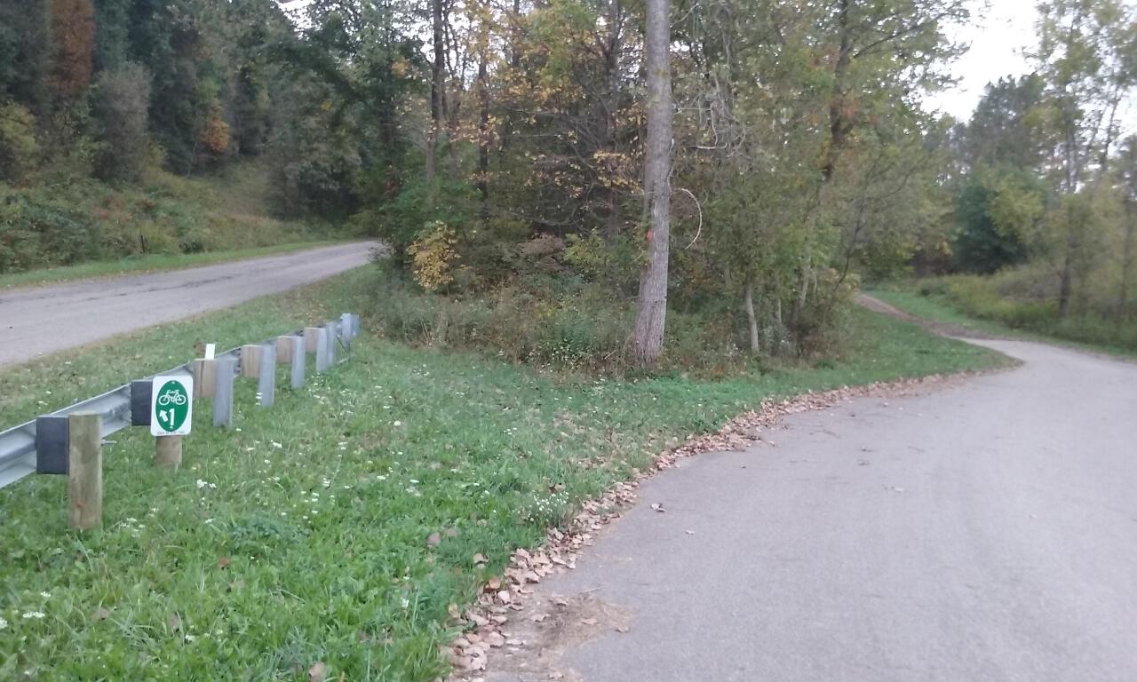
I got out the map, and it just said to take “the Mohican Valley Trail to Route 62.” I assumed that the road I just went under was Route 62, but there was no direct access to it. The sign appeared to want me to cut through the grass to the left of the trail, but that didn’t look like a state road just beyond. There were tire tracks through the grass, though, so I followed the sign. The road was a local back road that led to State Route 62. I made a left onto 62, and looking back, saw the Ohio to Erie Trail sign directing southbound travelers on to that same back road, so I knew I was on the right track.
State Route 62 is a busy, narrow road with lots of truck traffic and a few rolling hills. Fortunately, the route only follows this road for about three miles before turning onto some smaller county roads. The length and steepness of the hills on these back roads get worse, though. The winds were picking up and coming out of the northeast, which wasn’t good, since that’s the direction I was mainly traveling.
Being my fourth day in the saddle, the miles were starting to catch up to me. On every long bike trip I’ve taken, the fourth day always seems to be one of the worst. My theory is that no matter how much I train for a trip in advance, it’s nearly impossible to get four long training rides on four days in a row. So, on the fourth day of the actual trip, my body and mind are experiencing a unique challenge. By this time, this concept has probably worked its way into my brain and become a self-fulfilling prophesy. Regardless, I switched from “enjoying the ride” mode to “let’s just get this done” mode for much of the day.
About 13 miles later, I passed through the town of Killbuck to make my way onto the (thankfully flat) Holmes County Trail.
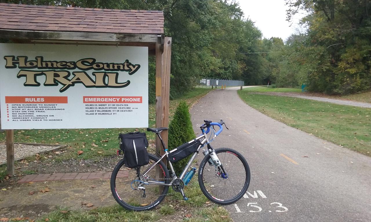
Holmes County is the unofficial “capital” of Ohio’s Amish country, and the trail was built to serve the Amish community as well as the general public. You may encounter horse-and-buggy drivers on the trail, as well as the inevitable by-product of the horses. On autumn days when the leaves are falling, watch out for horse manure “booby traps” hidden under the leaves.
The trail ends 15 miles north in the town of Fredericksburg. I decided to stop here for some lunch, and went into the Fredericksburg Market right on the main corner, based on the “Lunch Specials” sign they had on the sidewalk. When I inquired inside, they said the lunch specials were sold out. My other choice was Lem’s Pizza next door, but I decide to just grab one of the pre-made sandwiches in the Market, since I was already here. I washed that down with a chocolate milk.
The next 17 miles felt like déjà vu, with steeply rolling hills and headwinds through Amish farm country. It was very scenic, and the sun finally came out, but I got stuck back in “get it over with” mode and found it hard to enjoy until I finally reached the village of Dalton and got onto the Sippo Valley Trail.
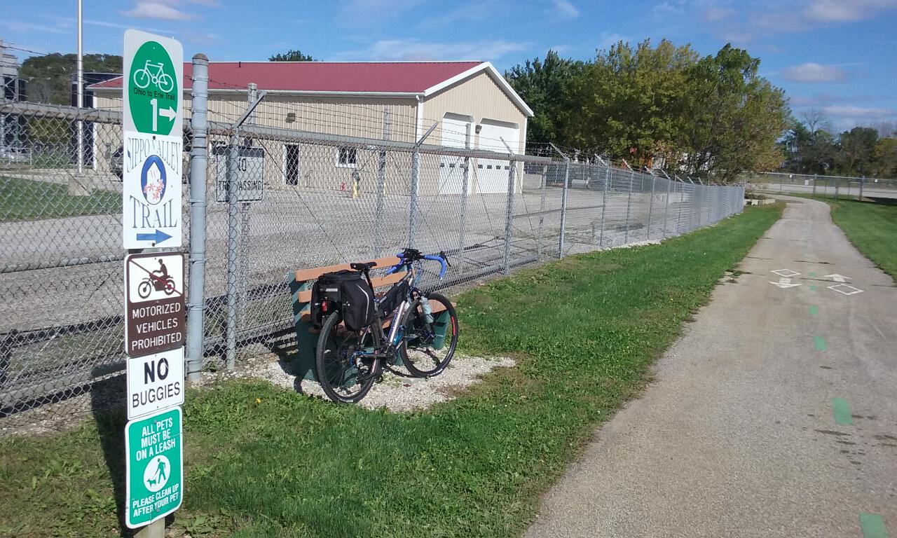
The Sippo Valley Trail is a mixture of pavement and crushed stone, passing through wooded areas, farms, and residential areas.
10 miles later, the trail ends as it connects to the Ohio & Erie Canal Towpath Trail just west of downtown Massillon. I recommend taking the sidewalk on the left side of the Lincoln Way bridge over the Tuscarawas River; that way, on the other side, all you have to do is make a hard left to get onto the Towpath without having to cross traffic.
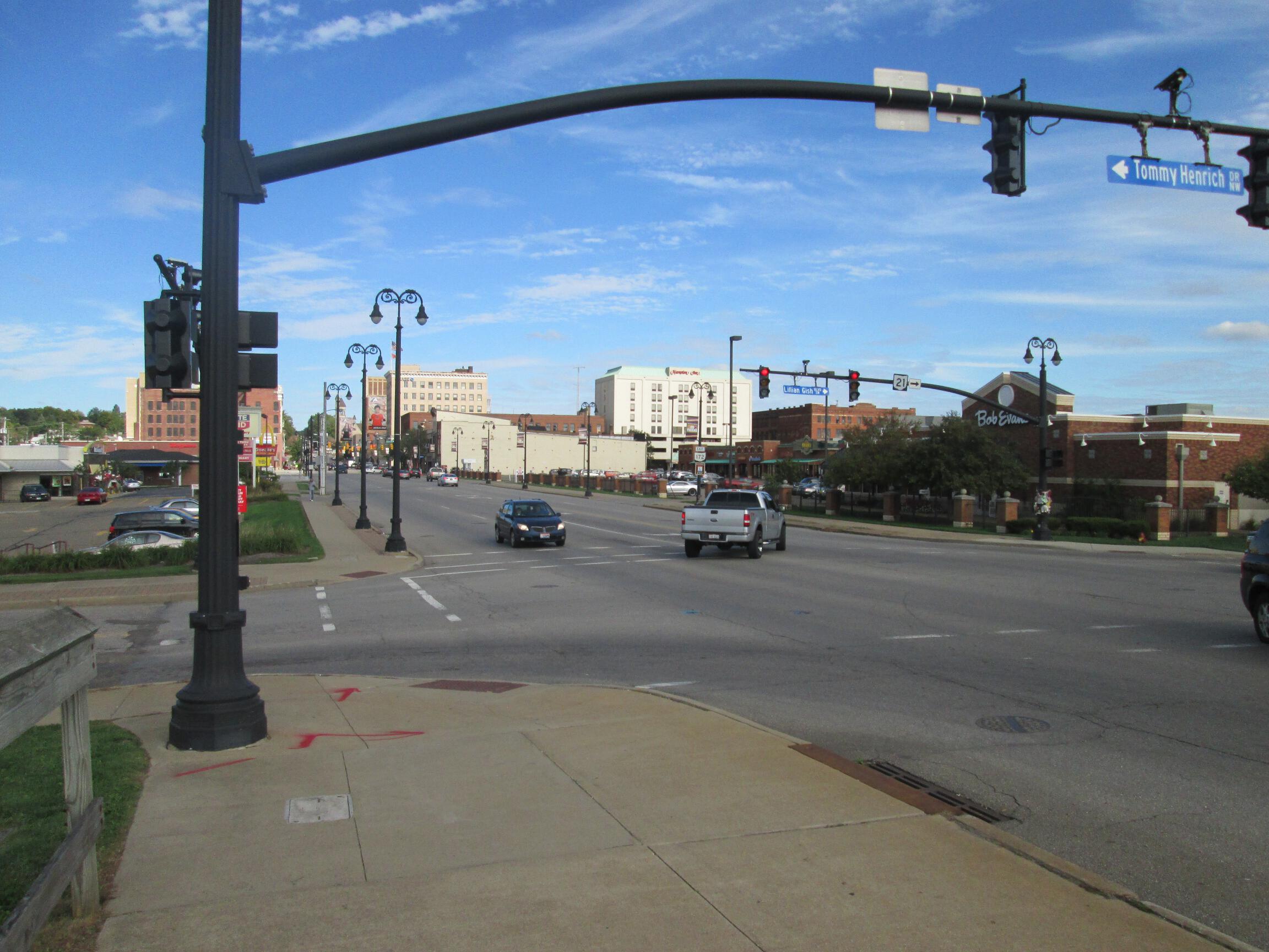
As I got to the other side of the bridge, I stopped to take in the view of downtown Massillon. Not that I have any particular affinity for the city, but on this day it represented the beginning of home turf–the final leg of my cross-state adventure, and getting on the Towpath Trail, the bicycle superhighway beloved by cyclists of all types in Northeast Ohio.
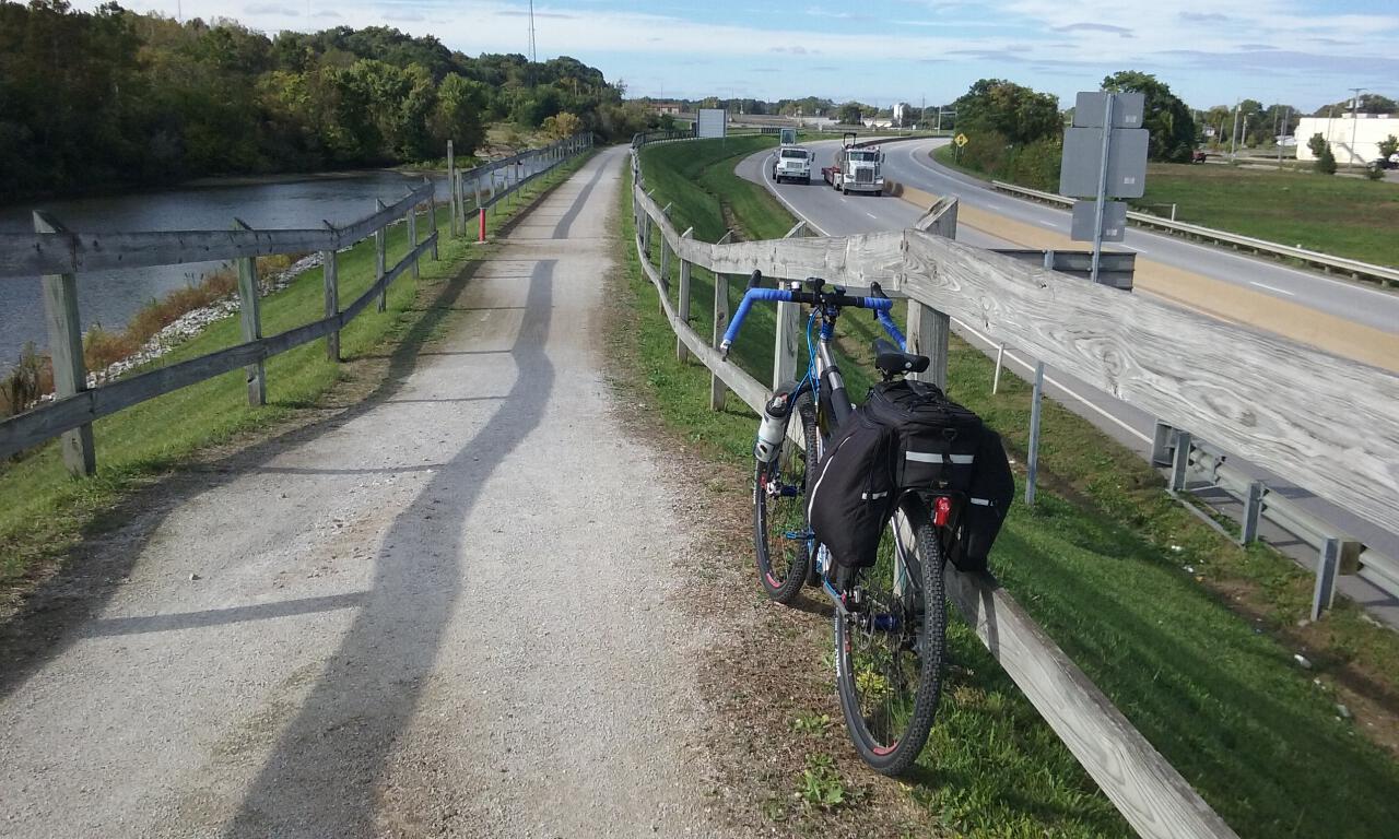
Leaving Massillon, the Towpath Trail traverses a raised earthen embankment, with State Route 21 to the right and the Tuscarawas River to the left.
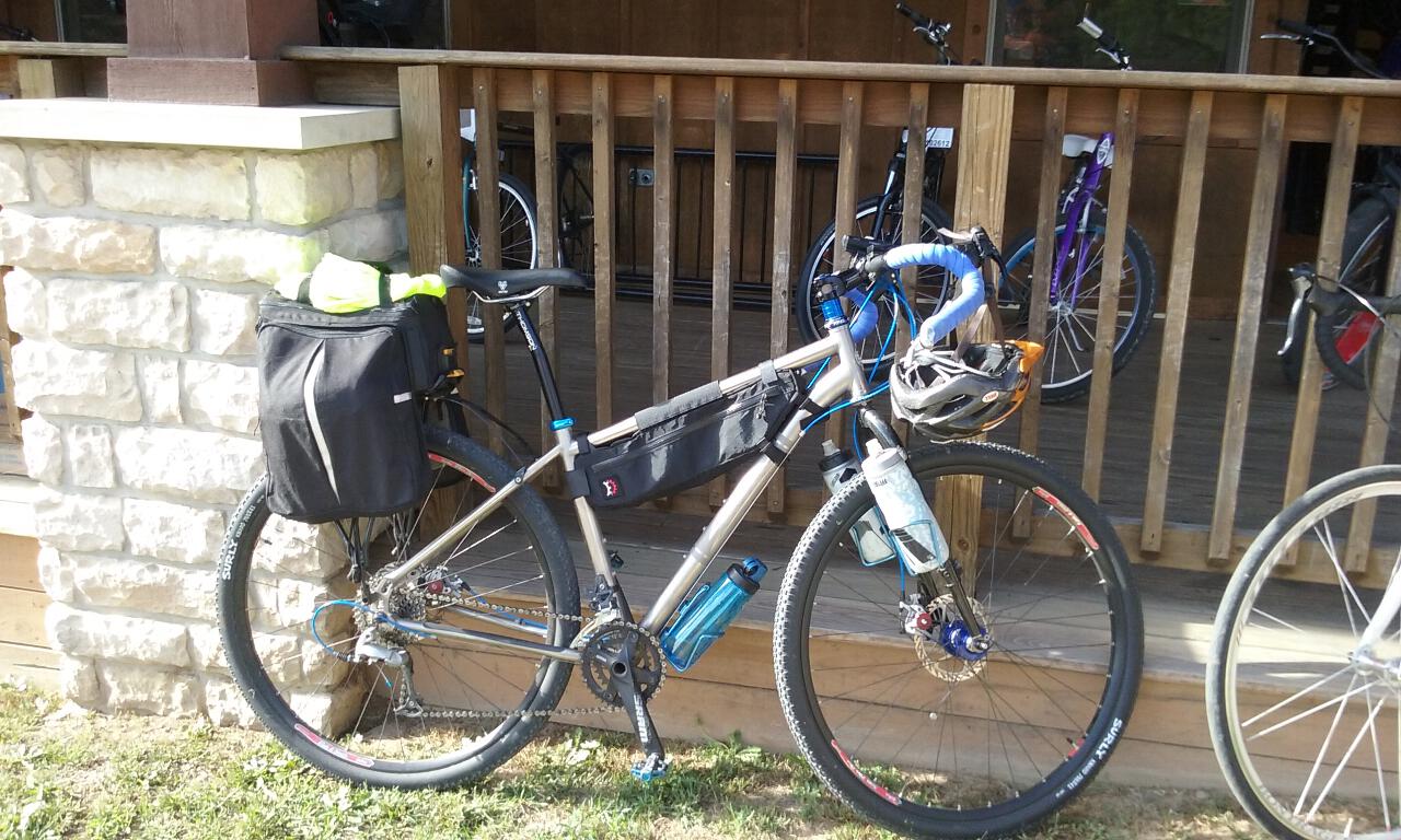
A short stretch out of town you’ll find the Lake Avenue plaza, where you’ll find Ernie’s Bike Shop and the Blue Heron Cafe if you need a bite to eat. I stopped at the bike shop to fill up my water bottles and top off the air in my tires.
The sun felt warm and toasty as I rested a bit, so I took my jacket off, but as I took off back on the Towpath, I found that it was still deceptively cool, and stopped again soon after to pull my jacket back on.
An easy eight or nine miles later, I arrived in Canal Fulton. My hosts for the evening were another Warm Showers contact, Ray and Dawn, who lived just a couple blocks from downtown and the Towpath Trail. Both had prior plans, so I would be on my own for dinner, but I met Ray just before he left for the evening, and he showed me into the house for a shower, and into the camper in their driveway, where I would be sleeping.

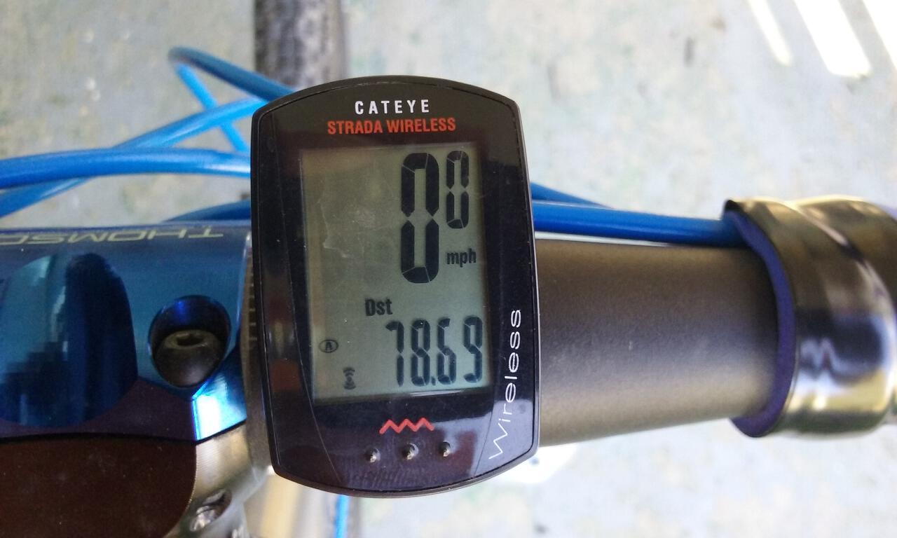
My mileage for the day was almost 79.
For many years I had heard good things about V-Li’s Thai Cuisine in Canal Fulton, so tonight I would finally have the chance to check it out. I ordered the wide noodles with chicken and broccoli, and it didn’t disappoint, especially paired with a Smuttynose Pumpkin Ale.
No visit to Canal Fulton (by bike or otherwise) is complete without a visit to the Cherry Street Creamery, conveniently located at the intersection of Cherry Street and the Towpath Trail. A hot fudge sundae was my choice from among the many fine ice cream options.
Ray and Dawn’s camper was warm and comfortable as I settled in for the night.


Leave a comment