
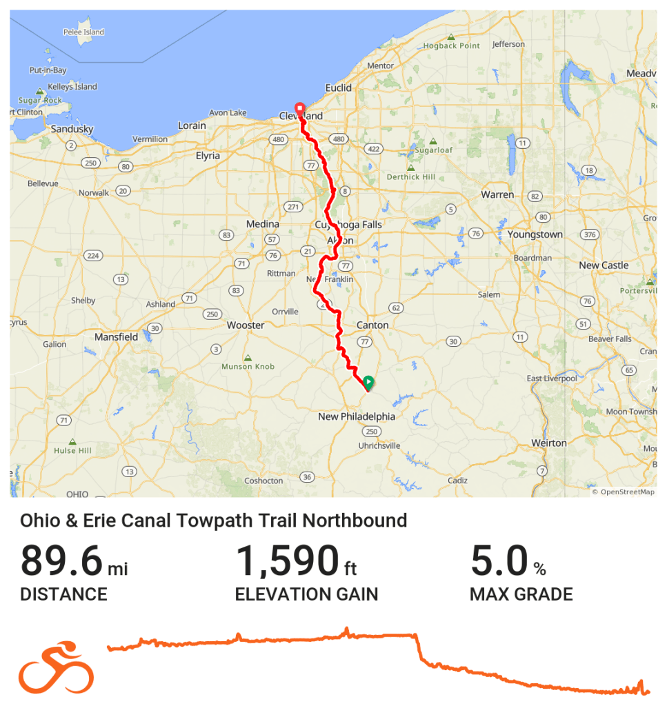
The Ohio & Erie Canal Towpath Trail is Northeast Ohio’s bicycling superhighway. It’s a biking and hiking trail that runs north and south through four of Northeast Ohio’s counties and numerous park jurisdictions, including the Cuyahoga Valley National Park. At almost 100 miles long, it connects Cleveland on the shore of Lake Erie to Dover, with the eventual goal of a complete off-road route reaching New Philadelphia some day.
The route of the Ohio & Erie Canal Towpath Trail closely parallels the Cuyahoga River from Akron north to Cleveland, and the Tuscarawas River south of Akron. It generally follows the path of the former Ohio & Erie Canal. The canal boats were towed by mules along a trail adjacent to the canal, thus the name “towpath.” Locals typically just call it The Towpath for short, although outside the area, that name may be ambiguous, as there are other “towpath” trails around the US.
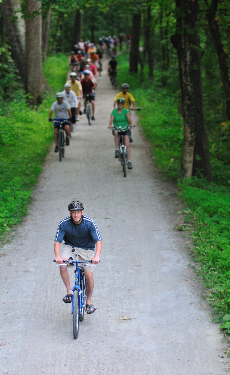
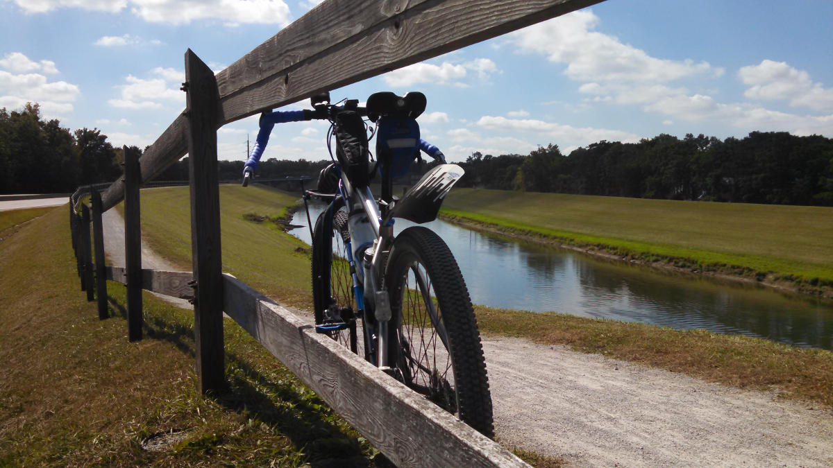
The surface of the Towpath is smooth crushed limestone, some hard-packed dirt and gravel, with occasional paved sections. The terrain is mostly flat and suitable for children and adults of all abilities.
The Towpath passes through a variety of wooded environments and urban neighborhoods, with scenic natural beauty and historic and cultural landmarks. There are numerous trailheads that provide parking and access to the trail. There are also options for camping near the trail for those who like to enjoy a multi-day biking or hiking adventure.
More about the name
The name “Ohio & Erie Canal Towpath Trail” causes confusion among some out-of-towners and locals alike. For various historical, political, and unknown reasons, local parks and other organizations have tended to re-use names or parts of names for local assets. In particular:
- Ohio & Erie Canal Reservation – This is a park within the Cleveland Metroparks system. About six miles of the Ohio & Erie Canal Towpath Trail runs through this park. There are also mountain bike trails, a bike skills park featuring a pump track and jump line, and a visitor center.
- Ohio to Erie Trail – This is not technically a trail, but a collection of trails and on-road connections that form a bicycle touring route between Cleveland and Cincinnati. The Ohio to Erie Trail route uses the Ohio & Erie Canal Towpath Trail between Cleveland and Massillon. More details about this route can be found at: ohiotoerietrail.org
- Erie Canalway Trail – This is a trail in the state of New York that connects Albany to Buffalo. Similar to the Ohio & Erie Canal Towpath Trail, it follows route of a former shipping canal, with canal boats still active on some parts. Find more info at: eriecanalway.org/explore/cycling
- Chesapeake & Ohio (C&O) Canal Towpath Trail – This trail, with the Great Allegheny Passage, forms the popular bike touring route between Washington, DC and Pittsburgh, PA. Info at: canaltrust.org and gaptrail.org
- Ohio & Erie Canalway National Heritage Area – Designated by Congress in 1996 to help preserve and celebrate the rails, trails, landscapes, towns, and sites that grew up along the first 110 miles of the canal that helped America and our nation grow. More info at: ohioanderiecanalway.com
- Canalway Partners – Coordinates activities of the Ohio & Erie Canalway National Heritage Area in Cuyahoga Counter. canalwaypartners.com
- Ohio & Erie Canalway Coalition – Coordinates activities of the Ohio & Erie Canalway National Heritage Area in Summit, Stark, and Tuscarawas counties. ohioeriecanal.org
Maps
Images link to RideWithGPS in a new browser tab.

Note: There is a new section on the southern end of the Towpath that extends the trail from State Route 212, along the east side of the Tuscarawas River, and ending about 4 miles south at State Route 416. I have not included this section in the maps above because I have not had the opportunity to personally scout it yet.
Trail Descriptions by County
Cuyahoga County
The northern end of the Towpath is at Canal Basin park, which is near downtown Cleveland and The Flats area on the east bank of the Cuyahoga River. The trail surface is all paved here. There’s easy access to local shops and restaurants as you pass through the Tremont neighborhood, the Steelyard Commons shopping plaza, along Jennings Road, and finally to Harvard Road.
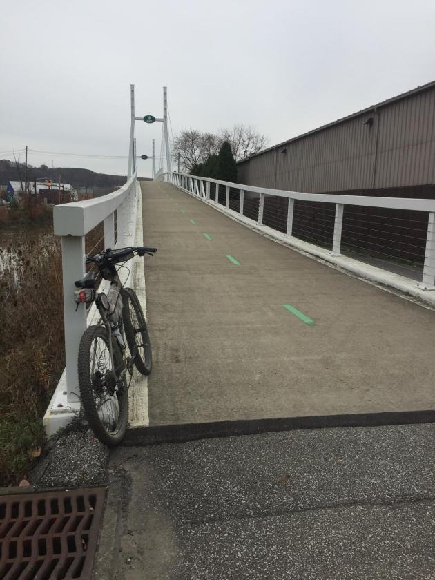
Traveling south from Harvard Road, the Towpath continues through the Cleveland Metroparks Ohio & Erie Canal Reservation. You can stop along the way to view exhibits highlighting the area’s industrial history, go fishing in the canal, and even take a detour to ride a few laps on the park’s mountain bike trail and skill park. You’ll cross over two majestic suspension bridges at Warner Road and Granger Road in Valley View.
At Lock 39 just south of Rockside Road near Independence, the Towpath enters the Cuyahoga Valley National Park, and the surface becomes crushed limestone. Here, you’ll also find the Rockside Station of the Cuyahoga Valley Scenic Railroad, the northernmost point the train travels. In a couple miles you’ll find the Canal Exploration Center, where you can view historical exhibits and information about canal era. A couple miles further south, the trail enters Summit County.
Summit County
In 2012, the Summit County section of the Towpath Trail was the first to be entirely completed within a county. In the north, the trail continues through the Cuyahoga Valley National Park, and through the villages of Peninsula. In Boston you’ll find the Boston Mill Visitor Center, which is the main information center for the national park, as well as the Trail Mix store right on the trail. In Peninsula, there are a couple of local restaurants and shops. South of the Botzum Trailhead, you leave the national park and enter the Summit Metro Parks. The trail is paved for a short stretch as it trail runs next to Merriman Road, where you’ll find plenty of food and drink options. The crushed limestone surface returns as you leave the business area.
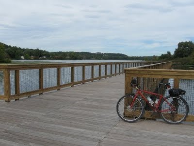
As you approach downtown Akron, the pavement returns, but you’ll find the most significant climb on the trail, as you gain about 120 feet of elevation in about one-half mile. If you detour off the trail just a block or two, you’ll be in the heart of the downtown business and entertainment district. Just south of downtown, the trail follows the unique floating bridges over Summit Lake. The crushed limestone surface returns near Barberton, then some more pavement near the village of Clinton. You’ll find a variety of shops and restaurants in Barberton if you take about a half-mile detour off the trail.
Stark County
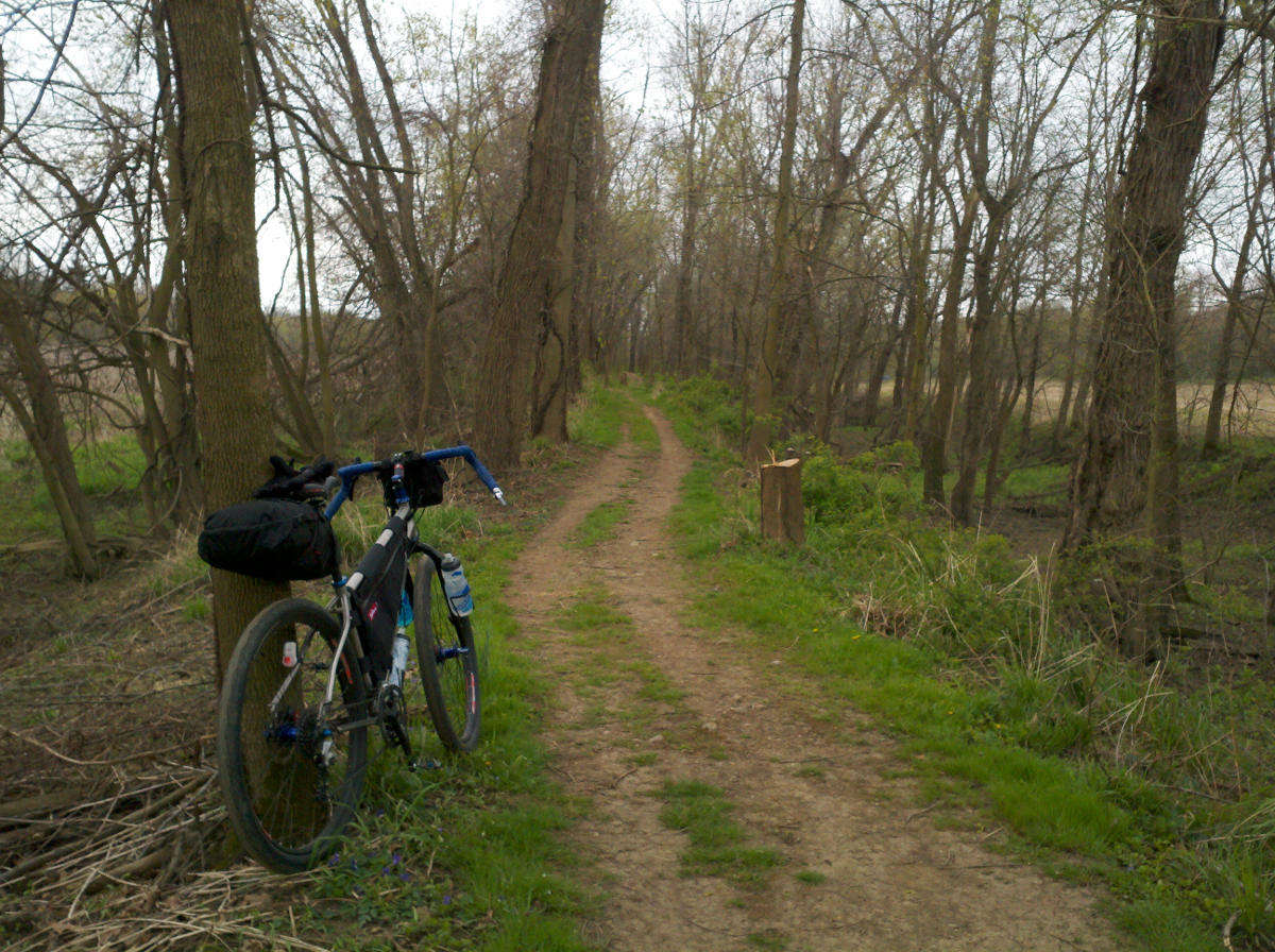
The Towpath crosses into Stark County just south of the village of Clinton. It passes through the cities of Canal Fulton and Massillon, both of which have many food and drink options available. Next to downtown Massillon, the trail runs along the top of a raised dyke that separates State Route 21 from the Tuscarawas River. There is a brief but well-marked on-street section through downtown Massillon. There are some brief pavement sections south of Massillon, but this area also contains some of the roughest parts of the trail, with some brief parts of gravel and hard-packed dirt.
Tuscarawas County
The Towpath Trail leaves Stark County and enters Tuscarawas County just northwest of the village of Bolivar. The dedicated trail ends in a residential area in Bolivar. Follow the signs for the on-street route through the village. Continue to follow the signs to Fort Laurens State Memorial and Museum, and then pick up the trail again from the back of the parking lot. The trail follows a bridge over Interstate 77, and then a few miles of fairly rough dirt doubletrack before it dead ends again at State Route 800. Turn left on Route 800, then take the next right over the restored steel truss Zoarville Station Bridge, then turn right onto the Zoar Valley Trail. This trail ends about 4 miles later at State Route 416 outside of Dover and New Philadelphia.
A Note About Mile Markers
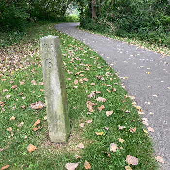
You may see these mile markers along the Towpath Trail. Please note that they are there for historical purposes only. In most cases, they do not represent the actual mileage on the present-day trail. Moreover, back in the days when the canal was active, the mileage markers were measured in nautical miles (1 nautical mile = 1.15078 land miles).
Detours, Closures, and other Alerts
The best source of information about current trail conditions is from the local park organizations themselves:
- Alerts & Closures from Cleveland Metroparks
- Current Conditions and Alerts from Cuyahoga Valley National Park
- Alerts from Summit Metro Parks
- Park & Trail Alerts from Stark Parks
- Tuscarawas County Parks Department – Phone (330) 365-3278
Towpath Trail Hours of Operation
The Ohio & Erie Canal Towpath Trail within the Cuyahoga Valley National Park is open 24 hours a day, seven days a week. It is the only trail within CVNP that is open 24/7.
The Towpath Trail in all other areas is open to users from dawn to dusk.


